Most modern necessities, like cell service, GPS and Wi-Fi, rely on radio frequencies flying around the Blue Planet. But gathering that data efficiently has been close to impossible – until now.
Meet HawkEye 360, a Herndon, Va.-based startup using formation-flying satellites to track Earth-bound radio frequencies around the world.
Just three years after launching, the company has moved from initial financing to spaceflight operations as it looks to disrupt the geolocation industry.
HawkEye was founded in 2015 by Chris DeMay as a spinoff from Boston-based venture creation firm Allied Minds, which licenses and commercializes technology from government and academic labs.
In short, it’s a radio frequency (RF) data analytics company. But what does that mean?
HawkEye operates a commercial satellite constellation that locates and identifies a broad set of RF signals coming from the Earth. It runs the data through algorithms, analyzing it along with other sources to offer services like maritime domain awareness and spectrum mapping and monitoring. Those reports are used by governments, shipping companies and military operations to track assets and identify distress signals.
Although RF signals are ubiquitous on the planet’s surface, this is the first commercially available product that can independently locate, process and track many of those signals, according to the company. It provides the coordinates and characteristics of signal emitters, making it more specific and trustworthy than satellite imagery.
And HawkEye has been on a fast track to sales, despite the difficulty and cost of space travel.
"The potential of the commercial geospatial industry grows every day — especially in partnership with the intelligence community."
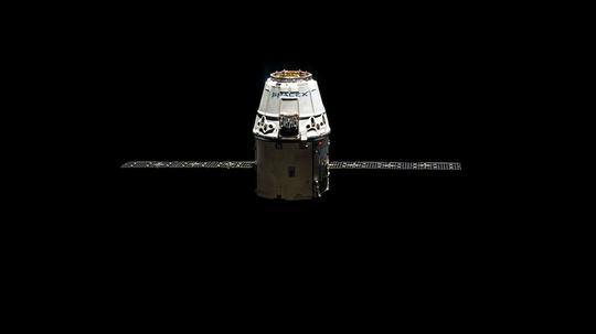
It launched its first three geolocation satellites in December 2018 on the SpaceX Falcon 9 rocket, securing a spot along with just 60 other small satellites.
“It took us about two months to do all the commissioning and testing, but we are very excited to announce the satellites are working very well,” CEO John Serafini told SpaceNews following the launch.
In February, Hawkeye successfully performed its first tracking missions, and in April it released its first mapping product called RFGeo. RFGeo uses the data generated by the satellites to provide a new type of geospatial data analysis, which it delivers in a standardized format for common tracking software.
But three spacefaring signal finders are just the beginning. It plans to launch three more satellites about every six months until its planned fleet of 18 are in orbit, at which time it will receive new radio signals every 30 to 45 minutes from every spot of the Earth.
RFGeo will initially identify and locate maritime radio channels, emergency distress beacons and vessel signals, with more applications on the way. The network soon will provide insights for markets including emergency response, telecommunications and – likely most profitably – defense.
“RFGeo provides our customers with a new view of activities on Earth using the RF spectrum,” product director Brian Chapman said in a statement. “We are enabling customers to link RF signal geolocations from our RFGeo product to events occurring around the world.”

To lead its reach into the military market, HawkEye recently added Robert Cardillo to its advisory board. Cardillo is the former director of the U.S. National Geospatial-Intelligence Agency and a longtime national security professional and geospatial expert, with hands-on knowledge of high-level defense decision making.
"The potential of the commercial geospatial industry grows every day — especially in partnership with the intelligence community," he said in a statement.
He joins a government-studded board that also includes Letitia Long, another former NGA director; former CIA Chief Information Officer Doug Wolfe; James Winnefeld, Jr., former U.S. Vice Chairman of the Joint Chiefs of Staff; and Robert Work, former U.S. Deputy Secretary of Defense; among 14 others.
HawkEye also has plenty of funding to guide it upward. The startup has raised more than $28 million from investors including Raytheon, Allied Minds, Space Angels, Razor’s Edge Ventures, Shield Capital Partners and Sumitomo Corp. of Japan.
The expertise and capital already has led HawkEye to several contracts with domestic and international governments, as well as a handful of enterprise clients. Most recently, it announced a partnership in May with Windward, a company focused on maritime risks.
“We’re committed to providing our clients with the biggest data and deepest insights to help them solve their maritime problems,” Windward co-founder and CEO Ami Daniel said in a statement. “That’s why we’re delighted to be working with HawkEye 360, and look forward to exploring how RF geolocations and analysis can offer our clients an even better service through enhanced risk modeling.”
The startup isn’t alone in the radio-focused space race. Its main competitor is Luxembourg startup Kleos Space, which has raised millions in government support to develop similar RF-based geolocation data and services. The competition will heat up after Kleos’ planned launch of its first four “scouting mission” satellites in early August.
But HawkEye is ready to race. The startup plans to launch its second three-satellite cluster in late 2019 or early 2020, having already fully financed the mission.
To check out moonshots in all 13 Inno markets, click here.