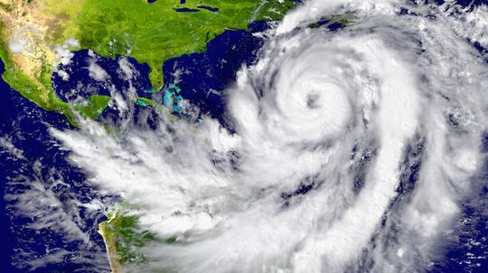
Hurricane season is here and while predictions about their appearance and movements are impressively advanced, Bethesda-based startup PlanetiQ has plans to make predicting them and other major storms even more precise. PlanetiQ announced on Tuesday that it has begun testing its new Pyxis weather sensor system, a new kind of weather prediction suite that uses GPS signals to collect 8 million data points a day, improving weather monitoring and forecasting for a much lower cost than the current system. Pyxis will go into the 12 satellites the company plans to launch in the next few years, the first commercial network of weather satellites in orbit.
“Weather has an immense human and societal impact and affects businesses on a daily if not hourly basis, with a $9.7 trillion economic influence globally,” said PlanetiQ CEO Anne Hale Miglarese. “Improving the weather forecast and developing innovative risk analytics tools are critical to mitigate these growing costs, and the key is more high-quality weather data.”
“Improving the weather forecast and developing innovative risk analytics tools are critical to mitigate these growing costs, and the key is more high-quality weather data.”
Pyxis will track GPS signals traveling through Earth’s atmosphere using a method called GPS Radio Occultation, Pyxis is unique according to PlanetiQ in having the smallest version of the GPS-RO sensor that is still powerful enough to read information from the Earth's surface from space. Pyxis takes the data and coverts it into measurements of temperature and other weather factors. The company compares them to weather balloons, but ones that can travel all over the globe and collect more information for a lower cost. It's a method that is more accurate for forecasting weather in terms of efficiency than any other currently used, especially for major storms like hurricanes.
“The Pyxis represents a major step forward in improving forecast accuracy for both routine weather and big storms, while leveraging the latest advances in science, technology and miniaturization to drive down costs,” said Chris McCormick, PlanetiQ's founder and leader of its sensor development team based out of Boulder, Co.
Right now, there isn't a lot of data that uses the GPS-RO method. McCormick helped develop the first system to use it, a joint project of the U.S. and Taiwan called the Constellation Observing System for Meteorology, Ionosphere, and Climate. Creating Pyxis and putting it into PlanetiQ's satellites will add that data, and the advances made since then, to the commercial world's databanks.
“The Earth’s atmosphere is radically under-sampled at present especially over the oceans which cover 70 percent of the Earth’s surface. With the speed of innovation in sensor technology, space hardware and launch, the weather forecast will dramatically change for the better in the near future,” McCormick said.
Check out an illustration of how the system works below.