D.C. geospatial mapping company Impact Observatory, which uses artificial intelligence and satellite imagery to power its technology, has raised a nearly $6 million seed round to bring its product to market — and multiply in size.
The company taps an AI-driven algorithm and real-time data to build digital maps that it plans to pitch to other businesses, nonprofits and governments to better track and understand the world's land and environmental shifts. Yes, that world currently has Google Maps and the like, but Impact Observatory officials said those don't indicate how much of an area may be forest or wetlands — or neither anymore because it's been turned into condominiums in the past year.
Instead, they hope to be an alternative to the U.S. Geological Survey's most recent national map, last updated in 2019, to help those with little expertise in either AI or space evaluate satellite imaging data to make better decisions about land use.
“We teach computers to turn satellite images into maps, and we use those maps to automate the process of mapping how the world is changing in near real time,” said Steve Brumby, co-founder and CEO of Impact Observatory, in an interview. “The richest companies and the richest countries spend a fortune on this type of data.”
At barely 3 years old, Impact Observatory hopes to tap into those fortunes — now with more than $5.9 million in a seed investment, in part, from distribution partner Esri International LLC, an affiliate of West Coast geospatial mapping giant Esri.
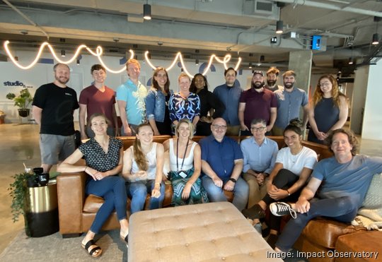
Brumby said he plans to use the funds to grow his team of 20 people — half of whom have settled into the company's downtown D.C. office at 900 19th St. NW — by about 25% to 50%. The money will also go toward furthering research and development of the pre-revenue company's products, which include a high-resolution, automated world map it released through Esri and Microsoft Azure Planetary Computer.
"Accessible maps of the planet are a fundamental tool for understanding the world, especially as the effects of climate change accelerate globally," Jack Dangermond, president and founder of Esri, said in a statement.
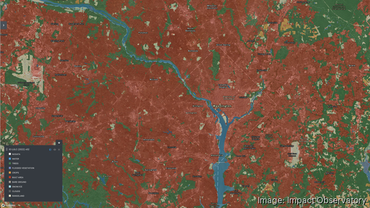
The idea, Impact Observatory said, is for customers to monitor a country's urban and agricultural trends to map out food security, measure changing carbon levels to help prevent climate change or evaluate an ecosystem's variations and threats to protect its biodiversity, among other uses. The company already provides some of its mapping capabilities through ArcGIS Living Atlas and the U.N. biodiversity lab for free, and clients for its world maps include the Karingani Game Reserve at the southern border of Mozambique and the D.C.-based International Food Policy Research Institute.
And as countries, agencies and nonprofit organizations crack down on sustainability and climate metrics and regulations, Brumby hopes for still more traction worldwide.
“We've won several million dollars of R&D from the U.S. government and also from commercial sources that are really interested in how continual monitoring from space really helps cities, communities and industry understand the impact of their actions and help understand: Are they ready for the climate, environmental and the sustainability crisis that's really rushing down on top of us?” Brumby said.
He was part of a team of scientists building GIS mapping technology for the government during his 16-year stint at the Los Alamos National Laboratory, ultimately spinning off with colleagues to co-found Descartes Labs in 2014 in New Mexico to commercialize the platform and serve as its chief technology officer. That company eventually grew to top 100 employees and $50 million in venture funding before private equity firm Antarctica Capital bought a controlling stake in it last August to grow it further.
But well before that, in 2018, Brumby was recruited to D.C. to lead the Geographic Visualization Lab at National Geographic Society, where he met fellow Impact Observatory co-founder Samantha Hyde, who now oversees the startup's operations. Its head of engineering, Mark Mathis, is another co-founder of Descartes Labs and alum of Los Alamos National Lab, as are others on the Impact Observatory leadership team.
Today, they must contend with potential competitors such as their former employer, Descartes Labs, and even current partner, Esri, as well as platforms that may focus on carbon-mapping, for instance. But they say they're hoping to bring more entities, perhaps with fewer financial means, into the fold.
“We're sort of further democratizing the technology and making it available so that every state — not just the U.S. government, not just the biggest companies on Wall Street, but every state and local government around the world — can get access to the type of data that the U.S. federal government takes for granted,” Brumby said.