The University of Missouri-St. Louis has hired a new leader for its geospatial technology-focused hub that's focused on research and workforce development.
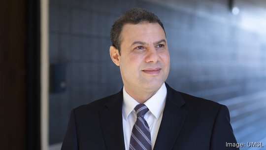
UMSL has named Reda Amer as director of its Geospatial Collaborative, effective this month. Amer has joined UMSL from Lamar University, where he was an assistant professor in its department of earth and space sciences and director of its geospatial center in Beaumont, Texas.
Launched in 2020 and initially known as the National Security and Community Policy Collaborative, UMSL’s Geospatial Collaborative is designed to connect the university with St. Louis’ geospatial technology sector. The Geospatial Collaborative was previously led by Will Werner, who departed his role as director in 2022.
Amer’s appointment comes as UMSL has placed a growing focus on geospatial technology, inking a partnership in 2021 with the National Geospatial-Intelligence Agency that’s aimed at preparing students to enter careers in geospatial intelligence. Additionally, UMSL has created a new undergraduate certificate in geographic information systems as it seeks to expand its geospatial certificate and degree offerings.
“We are pleased to welcome Reda to UMSL and have him leading the university’s work in the geospatial sector,” Vice Chancellor for Academic Affairs and Provost Steven Berberich said. “He brings a wealth of research experience in geospatial technology and also has helped create academic programming to train students in this emerging field of study. His expertise will help us as we seek to create academic programs that serve the workforce development needs of the National Geospatial-Intelligence Agency and others in St. Louis’ geospatial ecosystem.”
Amer has existing ties to St. Louis, having earned his Ph.D. in geophysics in 2011 from Saint Louis University. UMSL said in a news release that Amer plans to work toward expanding UMSL’s geospatial academic offerings, with a focus on creating a graduate certificate in GIS and master’s degree program in geospatial sciences. There are also plans to offer new training resources, with UMSL saying it has received $1 million-plus from the MoExcels Workforce Initiative that will be used to open a geospatial advanced technology lab and virtual reality lab on its campus.
“I’m so excited to come back to my home and to transfer my experience in teaching, research and developing geospatial programs to UMSL and to the greater St. Louis geospatial ecosystem,” Amer said. “My main objective is to develop a workforce pipeline and to make UMSL’s Geospatial Collaborative the hub for workforce development.”
In addition to his Ph.D, Amer, a native of Egypt, has a bachelor’s degree in geology and a master’s degree in remote sensing from Al-Azhar University in Cairo, Egypt.