Want more innovation news? Sign up for The Beat, Rhode Island Inno’s free weekly innovation newsletter. See past examples here.
Smartphones have a host of useful apps, in terms of geolocation, hiking tips and medical information, all incredibly useful for someone looking to plan a casual hike or a 20-mile trek. But what happens when your mobile phone dies or, inevitably, loses coverage?
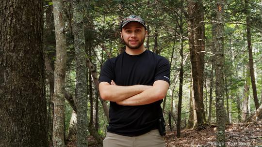
Rhode Island inventor and hiking enthusiast Kyle Corry is nearing 10,000 downloads for his Trail Sense app, which uses a phone’s sensors to provide navigation, weather forecasts and astronomy — all offline — even estimating avalanche risk.
Trail Sense, along with two other Rhode Island–based apps — Dockwa and Dibbs — were recently featured in a national Google Play campaign. According to Google, three companies were chosen from each state and will have their stories featured in a printed book and on other promotional materials and social channels.
Even though Corry doesn’t consider Trail Sense a business — he says it feels more like a side hobby, albeit a very time-consuming one — it takes up about 10 hours of his time a week and it has yet to make a profit. Then again, that was never the goal, he says.
A 'Swiss Army app'
Corry started working on the app in October of 2019 because he “wanted a modern, simple-to-use app I could use while hiking that didn’t depend on the Internet for anything.”
“The initial features I wanted to have were the ability to navigate using a compass, add beacons (known locations that I can navigate to), predict the weather using a barometer, and see the sunset and sunrise times,” he said. “I created Trail Sense with the goal that it would be free to everyone without ads, so I have not made any money off of the use of Trail Sense itself. I also don’t have any investors, but accept donations from people who really like the app.”
Corry said he doesn’t make much in donations and donates a percentage of what he gets to Weblate, the platform he uses to enable user-contributed translations.
“If I make enough in donations, I plan to put that money towards a mid-tier Samsung or Huawei device to improve the scope of my testing, since most of my error reports come from those devices,” he said.
Corry said Trail Sense is basically a Swiss Army app — a single program composed of over 30 tools, all of which work without the Internet and are designed to be fully usable if you open for the first time while on a hike. According to the developer, the most used tools are beacons, backtrack, weather and astronomy.
Using the "beacons" tool, explorers can create beacons using locations that are important before going on a hike, and then navigate to the beacon while hiking. Alternatively, it enables users to create beacons while on the trail that will then allow them to easily navigate back to points of interest in the future.
Backtrack, Corry said, is a background process you can enable to record your location at a fixed interval.
“This will allow you to retrace your steps in case you get lost. It also has the option to record the current cell signal strength along with your location,” he said. “Something really useful if you need to make a call or send a text while hiking in an area with poor cell phone coverage.”
On Google Play, Trail Sense boasts a "4.8 star" review and many of the reviews praise the app’s functionality, simplicity and the fact that it is freeware with no Internet access. Corry said he’s heard many stories from people who use his app — including it being used in training for search-and-rescue operations, by scouts, backpacking and hiking, trail creation/mapping, and even everyday use around the house (it also has features such as a bubble level and flashlight).
Moving forward, Corry said he has a lot of new features and improvements planned for Trail Sense. His goals for this year include the release of an offline map tool to take a photo of a trail sign and convert it into a fully functional digital map, as well as a cloud scanner to improve the weather predictions based on what clouds are present.
“In terms of growth, I hope to keep increasing my user base by ensuring Trail Sense works for everyone and is as easy to use as possible,” he said. “I’m always open to user suggestions for new tools in Trail Sense or ways to improve the app in general. Many of the tools in Trail Sense have been from the suggestions of my users.”
Sign up for Providence Business First’s free daily newsletter here