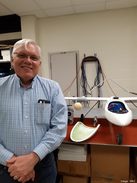
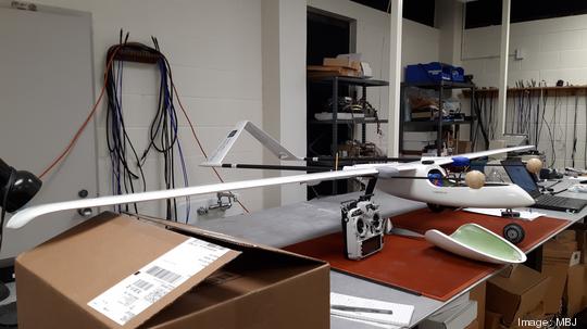
The official product name of the white, long-winged drone at the University of Memphis is the Albatross. But because it came unassembled and was put together by post-doctoral fellow Alfredo Ramirez, it was given a new name by his colleagues — the “Alfatross.”
It’s not the only drone named after Ramirez either. Another, belonging to the University of Central Florida (UCF), is called the “Alf Force One.”
Don’t think, however, that Ramirez wants an entire fleet of drones named after him.
“I hope not,” he said. “That’s not the way you want to achieve fame.”
Ramirez is working on the project "Multi-UAS Multi-Sensor Intelligence, Surveillance, and Reconnaissance,” which brings together researchers from the U of M, UCF, and the University of Arizona.
The focus is on finding effective combinations of sensors and drones for public use; and the effort is led by Eddie Jacobs, a U of M electrical and computer engineering professor, senior researcher in the Center for Applied Earth Science and Engineering Research (CAESAR), and director of the Drones, Robotics, and Navigation Enabled Systems Research Cluster at the FedEx Institute of Technology.
“If you think a little bit about unmanned aerial systems [drones], they are really, right now, like the PC was for awhile,” Jacobs said. “They are tools that allow you to do a lot of other interesting things.”
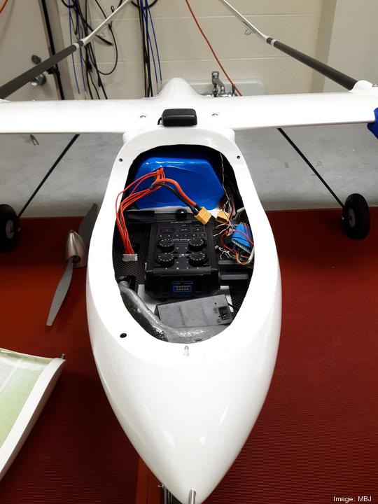
The Alfatross, one of those tools, is valued at about $10,000 — which seems expensive, until Jacobs tells you that they’ve ordered another drone worth $100,000.
He and his team, however, don’t have to skimp on quality. They’ve received a $2.7 million grant from the U.S. Army — or more specifically, the U.S. Combat Capabilities Development Command Army Research Laboratory — and plan on having a fleet of at least five drones.
Already, they’ve begun the work using what they have, with testing and data collecting taking place on early mornings in large fields. Ample space is a necessity. When I met with Jacobs and Ramirez and asked if we could fly the Alfatross in their lab, they chuckled. Takeoff requires 50 to 60 feet of space, and landing needs over 150 feet.
This isn’t the case for every unmanned aircraft system (UAS); the $100,000 drone that’s been ordered takes off vertically, eliminating the need for a runway.
Being precise
Regardless of how they become airborne, these drones — combined with the sensors the group attaches to them — could prove to be highly useful, and Jacobs noted potential agricultural and environmental uses.
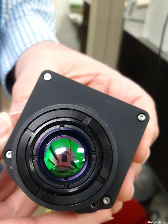
It’s important to note that when Jacobs talks about sensors, he’s typically referring to high-caliber cameras, and the ones acquired for this project can capture images using hundreds of colors on the same wavelength.
To put that in perspective, the cameras on most cell phones use three colors: red, green, and blue.
“The camera technology we’ll be working with, instead of just having three colors, over that same region, has hundreds,” Jacobs said. “So, we have a much finer look at how things are varying within that.”
Such cameras can provide heavily detailed information in the agricultural sector. When attached to the drones, they can reach areas that would otherwise be inaccessible.
This is particularly useful for farmers who practice precision agriculture, which is a more sustainable way to take care of problems among crops. Chemicals can be applied only where necessary, rather than dousing an entire field, and the drones can help identify the specific target areas.
As an example, take a cotton field. There is a problematic weed that will grow in them, called Palmer amaranth. Though that weed is slightly taller than a cotton plant, they’re still difficult to spot amid large swaths of crops, making it hard to pinpoint their locations. But with the right technology, it’s possible.
“If you look in certain areas of the light spectrum, it turns out that Palmer amaranth looks slightly different than cotton itself,” Jacobs explained.
So, you can fly drones over the field, have the sensors take images, and process them using artificial intelligence and machine learning, to identify where the Palmer amaranth plants are.
The project, however, is multifaceted, and goes beyond just this. Jacobs and co. are bringing together many components — including communication and collaboration between different drones.
“If a drone sees something of interest, and something is identified, an interrogator drone can go and take a look, and now you can have a little more information about the thing,” he said. “Maybe it would be advantageous to have a third drone come and look at it, as well. … Overall, [the project] involves sensors, communication between the drones themselves, artificial intelligence, and machine learning."