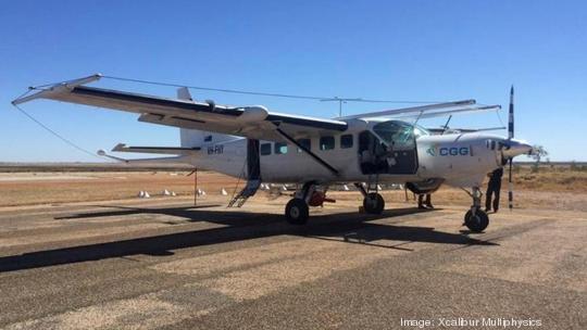
If you’re in a rural area, and happen to glance up and see a grey, low-flying airplane with a sensor towed behind it, don’t be alarmed — it isn’t an aircraft with a faulty engine, or a Maverick-style pilot veering too close to the ground.
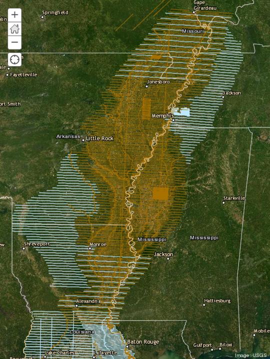
Chances are you’ve spotted an airplane contracted by the U.S. Geological Survey (USGS), which, over the next two to three months, will be mapping aquifers throughout the Mississippi Alluvial Plain (MAP), as well as parts of the adjacent Mississippi Embayment and Chicot Aquifer.
Now, that sentence might not seem like an eyeball magnet, but hear us out. The MAP is one of the most productive agricultural regions in the country, and, according to a press release, consists of 29,000 square miles of land in portions of Arkansas, Illinois, Kentucky, Louisiana, Mississippi, Missouri, and Tennessee — the Memphis area included.
The MAP depends on groundwater for irrigation, and if state and local leaders want to effectively evaluate and manage groundwater resources, critical data is needed.
Hence the need for this project, which will have an airplane — operated by Ontario-based Xcalibur Multiphysics — make low-level flights over more than 20 million acres and seven states within the MAP and adjacent areas.
Tools on the plane — an electromagnetic sensor will be towed 300 feet behind and 150 below the aircraft — are set to collect information about the geology in shallow aquifers of the region; and when the data analysis is complete, new maps will help USGS researchers understand the aquifer system that supports groundwater resources.
Flights will occur during daylight hours, but not in populated areas. And according to the release, there isn’t a health risk to people or animals. The pilots are also specially trained and approved for low-level flying.
This isn’t the first time this type of data has been acquired. From late 2019 to early 2020, using the USGS conducted a similar project, using the same airplane and instrumentation.